March 2021 Weather Discussion
-
tron777

- Major Hurricane
- Posts: 25387
- Joined: Fri Feb 26, 2021 5:10 pm
- Location: Burlington, KY
- Contact:
Re: March 2021 Weather Discussion
Good morning all! didn't have time to check my wx station. Just got back from my first Covid shot. Anyway.... the severe threat has ben reduced and only our SE counties have an isolated threat. For the rest of us, just periods of rain and some thunder only with windy conditions.

-
tron777
- Major Hurricane
- Posts: 25387
- Joined: Fri Feb 26, 2021 5:10 pm
- Location: Burlington, KY
- Contact:
Re: March 2021 Weather Discussion
Only 0.21" so far as of 8am at CVG. Unless something good happens, models will have grossly overdone rainfall amounts. The wind is probably going to be the bigger deal esp after the front passes tonight.
-
BookNerdCarp

- EF1 Tornado
- Posts: 416
- Joined: Fri Feb 26, 2021 5:57 pm
Re: March 2021 Weather Discussion
Don't see much in ways of severe weather as well
*_*_*_*_*_*_*_*_*_*_*_*_*_*_*_*_*_*_*_*_*_*
Ripley, OH (Brown County)
Home of the "Cold Rain Haters"
*_*_*_*_*_*_*_*_*_*_*_*_*_*_*_*_*_*_*_*_*_*
Ripley, OH (Brown County)
Home of the "Cold Rain Haters"
*_*_*_*_*_*_*_*_*_*_*_*_*_*_*_*_*_*_*_*_*_*
-
tron777
- Major Hurricane
- Posts: 25387
- Joined: Fri Feb 26, 2021 5:10 pm
- Location: Burlington, KY
- Contact:
Re: March 2021 Weather Discussion
The low is track a bit to far to the south plus it is weakening as it moves in. Still won't discount an isolated chance for your hood, but it's very very low. Better chances will be in Central and especially Eastern KY where they will have had some sunshine.
-
young pup
- EF4 Tornado
- Posts: 753
- Joined: Wed Mar 03, 2021 7:13 pm
- Location: Grandview ( Westside of downtown CMH)
Re: March 2021 Weather Discussion
6 tenths of an inch so far. Had standing water around my tree.
-
tron777
- Major Hurricane
- Posts: 25387
- Joined: Fri Feb 26, 2021 5:10 pm
- Location: Burlington, KY
- Contact:
Re: March 2021 Weather Discussion
CVG is up to 0.35" as of 10am.
-
MVWxObserver
- Hurricane
- Posts: 6889
- Joined: Fri Feb 26, 2021 7:48 pm
- Location: Greenville, OH
Re: March 2021 Weather Discussion
My Dad took Mom for an 8 o'clock routine doc appt this morning and while backing out of the driveway he noticed the gauge already had an inch. :grin: Wonderful to hear and more of the liquid gold today through this evening will help erode away the D0 that was starting to encompass Darke and part of Preble counties. 
Currently 41 here in G'ville.
Currently 41 here in G'ville.
Eric
Greenville, OH
Greenville, OH
-
MVWxObserver
- Hurricane
- Posts: 6889
- Joined: Fri Feb 26, 2021 7:48 pm
- Location: Greenville, OH
Re: March 2021 Weather Discussion
Wind Advisory has been extended until 5 AM Fri with gusts to 50 mph expected and higher gusts between 50 and 55 mph possible for the Miami Valley and parts of the Tri-state.
Eric
Greenville, OH
Greenville, OH
-
tron777
- Major Hurricane
- Posts: 25387
- Joined: Fri Feb 26, 2021 5:10 pm
- Location: Burlington, KY
- Contact:
Re: March 2021 Weather Discussion
Awesome news Eric! 56 at CVG but with NE winds, that'll kill the severe threat here locally. Not sure Matt what the wind direction is for your hood attm. Current radar shows the dry slot moving in from the south. The bulk of the heavier rains now are along and N of I-70.
-
tron777
- Major Hurricane
- Posts: 25387
- Joined: Fri Feb 26, 2021 5:10 pm
- Location: Burlington, KY
- Contact:
Re: March 2021 Weather Discussion
0.42" event total at CVG as of 11am. Since midnight, I have 0.31" in the books.
Re: March 2021 Weather Discussion
1.4" so far and still coming down. Lots of standing water and ponding on the roads.
Tipp City, Ohio
Southern Miami County
I75 Corridor 3 miles north of KDAY
Southern Miami County
I75 Corridor 3 miles north of KDAY
-
young pup
- EF4 Tornado
- Posts: 753
- Joined: Wed Mar 03, 2021 7:13 pm
- Location: Grandview ( Westside of downtown CMH)
Re: March 2021 Weather Discussion
Up to 9 tenths here. Temp has cooled down some since I was last outside.
-
tron777
- Major Hurricane
- Posts: 25387
- Joined: Fri Feb 26, 2021 5:10 pm
- Location: Burlington, KY
- Contact:
Re: March 2021 Weather Discussion
Looking ahead to the next cold front... not sure this early with regards to severe wx. The low should be a cutter well to our NW so we should have a better airmass to work with. The problem as you would expect this far away is timing. Todays 12Z GFS has showers coming in Tues night with a frontal passage Wed morning so that is not good for severe wx. The overnight Euro run was slower, more of a Wed afternoon and evening deal which would be better for t-storm development. A wait and see game for sure but just wanted to throw that out there for discussion in the coming days. The front also looks to have a secondary low develop along it for a one-two punch. With the faster GFS solution, low #2 would miss us to the east. With the slower Euro solution, we would get more of a heavy rain threat for the 2nd half of next week. GFS would mean a cool down, while the Euro would keep us milder. These issues will be the next forecasting headache for us. Until then, we're waiting for this system to get out of our hair since some rain and wind will continue to be issues for us. Dry but a windy and cold Friday will give way to a fantastic weekend! Cool mornings, but pleasant afternoons with a dry airmass in place and wall to wall sunshine expected. Even going into early next week, Monday and Tuesday should be very nice with highs possibility getting close to 70 esp by Tuesday.
-
Bgoney

- Tropical Storm
- Posts: 4973
- Joined: Fri Feb 26, 2021 7:09 pm
- Location: East clermont, 3mls north of Williamsburg
Re: March 2021 Weather Discussion
Hasn't been a true dry slot , at least here in East Hamilton County. Been misting or light rain the whole day and should remain so the rest of today, with some moderate showers developing also.
Proud owner of Best Guess Forecast Center (BGFC)
Former owner of Gut Feeling Forecast (GFF) and Doppler Infinity
Former owner of Gut Feeling Forecast (GFF) and Doppler Infinity

-
MVWxObserver
- Hurricane
- Posts: 6889
- Joined: Fri Feb 26, 2021 7:48 pm
- Location: Greenville, OH
Re: March 2021 Weather Discussion
Flood Advisory
Flood Advisory
National Weather Service Wilmington OH
1201 PM EDT Thu Mar 18 2021
OHC011-021-037-091-107-109-149-182000-
/O.NEW.KILN.FA.Y.0005.210318T1601Z-210318T2000Z/
/00000.N.ER.000000T0000Z.000000T0000Z.000000T0000Z.OO/
Auglaize OH-Champaign OH-Darke OH-Logan OH-Mercer OH-Miami OH-Shelby
OH-
1201 PM EDT Thu Mar 18 2021
The National Weather Service in Wilmington has issued a
* Flood Advisory for...
Auglaize County in west central Ohio...
Champaign County in west central Ohio...
Darke County in west central Ohio...
Logan County in west central Ohio...
Mercer County in west central Ohio...
Miami County in west central Ohio...
Shelby County in west central Ohio...
* Until 400 PM EDT.
* At 1201 PM EDT, radar and automated rain gauges indicated heavy
rain. Minor flooding is ongoing or expected to begin shortly in
the advisory area. Between 1.5 and 2 inches of rain have fallen.
Some locations that may experience flooding include...
Dayton, Troy, Sidney, Piqua, Bellefontaine, Greenville, Urbana,
Celina, Wapakoneta, Tipp City, St. Marys, West Milton, Coldwater,
New Bremen, Minster, Versailles, Covington, St. Henry, Arcanum and
St. Paris.
Additional rainfall of up to 0.5 inches is expected over the area.
&&
$$
AR
Eric
Greenville, OH
Greenville, OH
-
tron777
- Major Hurricane
- Posts: 25387
- Joined: Fri Feb 26, 2021 5:10 pm
- Location: Burlington, KY
- Contact:
Re: March 2021 Weather Discussion
Wow... the big rains the models originally had for us, ended up being an I-70 on northward event. Just glad it wasn't snow LOL
Bgoney… are you correct! It's not a true dry slot where you'd see no precip and / or sunshine so I mis-posted earlier. A lull in the precip or diminishing precip trends probably would have been a better choice of words.
Bgoney… are you correct! It's not a true dry slot where you'd see no precip and / or sunshine so I mis-posted earlier. A lull in the precip or diminishing precip trends probably would have been a better choice of words.
-
tron777
- Major Hurricane
- Posts: 25387
- Joined: Fri Feb 26, 2021 5:10 pm
- Location: Burlington, KY
- Contact:
Re: March 2021 Weather Discussion
Current 12Z Euro is still slower then the GFS with the onset of rain with our next system. Still looking like early Wed afternoon vs the Tues night scenario that the GFS has. I like the slower timing of the Euro at this point.

Re: March 2021 Weather Discussion
Wonder if ILN may eventually expand the WA down another row or two. Some of the high res models show advisory gusts in the metro area later.
Silverton, OH
Co-Owner of Ohio Valley Weather Center LLC
https://www.facebook.com/ovwcllc
Co-Owner of Ohio Valley Weather Center LLC
https://www.facebook.com/ovwcllc
-
MVWxObserver
- Hurricane
- Posts: 6889
- Joined: Fri Feb 26, 2021 7:48 pm
- Location: Greenville, OH
Re: March 2021 Weather Discussion
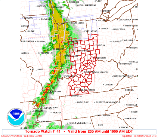
https://www.spc.noaa.gov/products/watch ... _radar.gif
Tim's Greenville, SC area under a Tornado Watch until 6 PM.
* Primary threats include...
A couple tornadoes possible
Isolated damaging wind gusts to 65 mph possible
Isolated large hail events to 1.5 inches in diameter possible
Tim's Greenville, SC area under a Tornado Watch until 6 PM.
* Primary threats include...
A couple tornadoes possible
Isolated damaging wind gusts to 65 mph possible
Isolated large hail events to 1.5 inches in diameter possible
Eric
Greenville, OH
Greenville, OH
Re: March 2021 Weather Discussion
Hey Eric and just saw that and it looks like there is a tornado near Spartanburg and that is about 40 miles northeast of where the SC house is located . Looks like the Greenville area is a place that stronger storms form off the mountains but are not severe enough until it passes most of the area. This is what I have noticed over the past 2 years. Weather looks great down there early next week and have lots of outdoor things to keep me busy.MVWxObserver wrote: ↑Thu Mar 18, 2021 2:44 pm https://www.spc.noaa.gov/products/watch ... _radar.gif
Tim's Greenville, SC area under a Tornado Watch until 6 PM.
* Primary threats include...
A couple tornadoes possible
Isolated damaging wind gusts to 65 mph possible
Isolated large hail events to 1.5 inches in diameter possible
-
tron777
- Major Hurricane
- Posts: 25387
- Joined: Fri Feb 26, 2021 5:10 pm
- Location: Burlington, KY
- Contact:
Re: March 2021 Weather Discussion
They should. I can hear the wind roaring out there from time to time. I know we're getting 40+ mph gusts here for sure. Temps also rapidly dropping. Down to 50 currently.
-
tron777
- Major Hurricane
- Posts: 25387
- Joined: Fri Feb 26, 2021 5:10 pm
- Location: Burlington, KY
- Contact:
Re: March 2021 Weather Discussion
Hopefully no issues for your hood down there Tim! I imagine you'll be in flip-flop mode next week. :grin:tpweather wrote: ↑Thu Mar 18, 2021 3:09 pmHey Eric and just saw that and it looks like there is a tornado near Spartanburg and that is about 40 miles northeast of where the SC house is located . Looks like the Greenville area is a place that stronger storms form off the mountains but are not severe enough until it passes most of the area. This is what I have noticed over the past 2 years. Weather looks great down there early next week and have lots of outdoor things to keep me busy.MVWxObserver wrote: ↑Thu Mar 18, 2021 2:44 pm https://www.spc.noaa.gov/products/watch ... _radar.gif
Tim's Greenville, SC area under a Tornado Watch until 6 PM.
* Primary threats include...
A couple tornadoes possible
Isolated damaging wind gusts to 65 mph possible
Isolated large hail events to 1.5 inches in diameter possible
Re: March 2021 Weather Discussion
Temp down to 46 here. Winds gusting over 30 mph.
Mike B.
Miamisburg, OH
The KING of the domes!

Miamisburg, OH
The KING of the domes!
