As of 6/1 it is down to -3.04! The marine heat wave off the Japan Coast is just ridiculous! The JMA is reporting that Tokyo has not seen a below avg month temp wise since late 2022.
June 2024 Weather Discussion
-
tron777

- Major Hurricane
- Posts: 25364
- Joined: Fri Feb 26, 2021 5:10 pm
- Location: Burlington, KY
- Contact:
Re: June 2024 Weather Discussion

-
Bgoney

- Tropical Storm
- Posts: 4959
- Joined: Fri Feb 26, 2021 7:09 pm
- Location: East clermont, 3mls north of Williamsburg
Re: June 2024 Weather Discussion
Return of the blob, beware the blob, mother of all blobs. Clearly going to be a pattern driver going forward, question is in what capacity does it influence our summer. Hot and dry?, hot and wet? (frequent ridge riders).
Proud owner of Best Guess Forecast Center (BGFC)
Former owner of Gut Feeling Forecast (GFF) and Doppler Infinity
Former owner of Gut Feeling Forecast (GFF) and Doppler Infinity
-
tron777
- Major Hurricane
- Posts: 25364
- Joined: Fri Feb 26, 2021 5:10 pm
- Location: Burlington, KY
- Contact:
Re: June 2024 Weather Discussion
My stance has been hot and dry for July and August due to this and the developing La Nina. Hope I am wrong and it turns into a ridge rider pattern instead.Bgoney wrote: ↑Mon Jun 03, 2024 2:11 pmReturn of the blob, beware the blob, mother of all blobs. Clearly going to be a pattern driver going forward, question is in what capacity does it influence our summer. Hot and dry?, hot and wet? (frequent ridge riders).
-
Bgoney
- Tropical Storm
- Posts: 4959
- Joined: Fri Feb 26, 2021 7:09 pm
- Location: East clermont, 3mls north of Williamsburg
Re: June 2024 Weather Discussion
tron777 wrote: ↑Mon Jun 03, 2024 2:15 pmMy stance has been hot and dry for July and August due to this and the developing La Nina. Hope I am wrong and it turns into a ridge rider pattern instead.Bgoney wrote: ↑Mon Jun 03, 2024 2:11 pmReturn of the blob, beware the blob, mother of all blobs. Clearly going to be a pattern driver going forward, question is in what capacity does it influence our summer. Hot and dry?, hot and wet? (frequent ridge riders).
A hot and dry period is almost inevitable, but hoping these are more normal hot/dry periods lasting a couple weeks at a time broken up by a ridge riding period. Rather than what we’ve seen in recent summers of 6 weeks +. I have no idea, at this point it’s wishful thinking
Proud owner of Best Guess Forecast Center (BGFC)
Former owner of Gut Feeling Forecast (GFF) and Doppler Infinity
Former owner of Gut Feeling Forecast (GFF) and Doppler Infinity
-
Bgoney
- Tropical Storm
- Posts: 4959
- Joined: Fri Feb 26, 2021 7:09 pm
- Location: East clermont, 3mls north of Williamsburg
Re: June 2024 Weather Discussion
Bgoney wrote: ↑Mon Jun 03, 2024 2:28 pmtron777 wrote: ↑Mon Jun 03, 2024 2:15 pmMy stance has been hot and dry for July and August due to this and the developing La Nina. Hope I am wrong and it turns into a ridge rider pattern instead.Bgoney wrote: ↑Mon Jun 03, 2024 2:11 pmReturn of the blob, beware the blob, mother of all blobs. Clearly going to be a pattern driver going forward, question is in what capacity does it influence our summer. Hot and dry?, hot and wet? (frequent ridge riders).
A hot and dry period is almost inevitable, but hoping these are more normal hot/dry periods lasting a couple/3 weeks at a time broken up by a ridge riding period. Rather than what we’ve seen in recent summers of 6 weeks +. I have no idea, at this point it’s wishful thinking
Proud owner of Best Guess Forecast Center (BGFC)
Former owner of Gut Feeling Forecast (GFF) and Doppler Infinity
Former owner of Gut Feeling Forecast (GFF) and Doppler Infinity
Re: June 2024 Weather Discussion
Good Afternoon and a tad muggy this afternoon but with only partial sunshine does not feel bad. No changes in the forecast for the remainder of the week with the best shot at getting some decent rains will be later on Wednesday through Thursday morning. Another nice shot of cooler air coming in by then and we will see how the weekend turns out. My son up in Wausau has went from a drought last summer to rains that won't stop. His pond is overflowing and the small river at the end of the property is flowing quite nicely. Mother Nature loves to balance things out in her own way and without her the planet would be a mess.
My summer forecast ended up rather close to normal and again 1-2 degrees either side of normal is normal in my books. Good thing is we are starting out quite nicely for the first two weeks and if we can get a few inches of rain by mid-month that is a win in my book.
If the Hurricane season is busy like many experts believe I am not sure that is a bad thing in terms of heat. Depending where they hit the USA is key of course and maybe if the number is high some of that moisture from a few systems makes its way northward and we break some of the short term heat that occurs almost every summer. Every summer is different but I agree that having a 60-90 day streak with little or no rain sounds horrible but doubt that happens this summer
-
tron777
- Major Hurricane
- Posts: 25364
- Joined: Fri Feb 26, 2021 5:10 pm
- Location: Burlington, KY
- Contact:
Re: June 2024 Weather Discussion
82 for my high today, currently sitting at 80. We'll see how much coverage we can get for tomorrow afternoon and evening, otherwise as Tim mentioned, Wed and Wed evening will be our best chance.
-
MVWxObserver
- Hurricane
- Posts: 6883
- Joined: Fri Feb 26, 2021 7:48 pm
- Location: Greenville, OH
Re: June 2024 Weather Discussion
CVG reached 80 and both DAY / CMH 84 today.
Last edited by MVWxObserver on Tue Jun 04, 2024 8:52 am, edited 1 time in total.
Eric
Greenville, OH
Greenville, OH
-
tron777
- Major Hurricane
- Posts: 25364
- Joined: Fri Feb 26, 2021 5:10 pm
- Location: Burlington, KY
- Contact:
Re: June 2024 Weather Discussion
Good morning all! Not much change to the forecast. A chance of storms this afternoon and evening and then Wed into Wed night continues to be our wettest time period this week. Thurs and Fri look good. For the weekend, the GFS looks nice now on Sat but Sunday and Monday looks like periods of rain / storms. Euro is still more north with the upper low so Sat is dry, Sun and Mon have very small rain chances. I'm still waiting to see which model wins the battle. It's a difference between clouds, showers and 60s versus partly cloudy skies and the 70s.

Re: June 2024 Weather Discussion
Signal has been around for a while for a northwest flow regime the last week and a half of the month and beyond. Right on the edge of the heat ridge. Very favorable setup for the MCS train to startup. Derecho anyone? It’s possible in that kind of setup…
You do not have the required permissions to view the files attached to this post.
Silverton, OH
Co-Owner of Ohio Valley Weather Center LLC
https://www.facebook.com/ovwcllc
Co-Owner of Ohio Valley Weather Center LLC
https://www.facebook.com/ovwcllc
-
tron777
- Major Hurricane
- Posts: 25364
- Joined: Fri Feb 26, 2021 5:10 pm
- Location: Burlington, KY
- Contact:
Re: June 2024 Weather Discussion
I would gladly take the rain that is for sure! Anything severe wx wise is just an added bonus.
Re: June 2024 Weather Discussion
Same long range models show below average precip but that’s to be expected since MCSs are on the mesoscale and globals have an issue with those. I don’t see a super wet pattern by any means but definitely repeated chances for thunderstorm complexes. Like you said we will take the rain as the heat begins to build in and dry things out! Lots of upper 80s-middle 90s in a setup like this with the core of the heat to our west and southwest.
Silverton, OH
Co-Owner of Ohio Valley Weather Center LLC
https://www.facebook.com/ovwcllc
Co-Owner of Ohio Valley Weather Center LLC
https://www.facebook.com/ovwcllc
-
tron777
- Major Hurricane
- Posts: 25364
- Joined: Fri Feb 26, 2021 5:10 pm
- Location: Burlington, KY
- Contact:
Re: June 2024 Weather Discussion
Yeah and humid as hell too. Ugh.... But at least we are good to go from seeing any 90s IMO though probably mid June at the very least. I'll take what I can get!Trevor wrote: ↑Tue Jun 04, 2024 6:00 amSame long range models show below average precip but that’s to be expected since MCSs are on the mesoscale and globals have an issue with those. I don’t see a super wet pattern by any means but definitely repeated chances for thunderstorm complexes. Like you said we will take the rain as the heat begins to build in and dry things out! Lots of upper 80s-middle 90s in a setup like this with the core of the heat to our west and southwest.
Re: June 2024 Weather Discussion
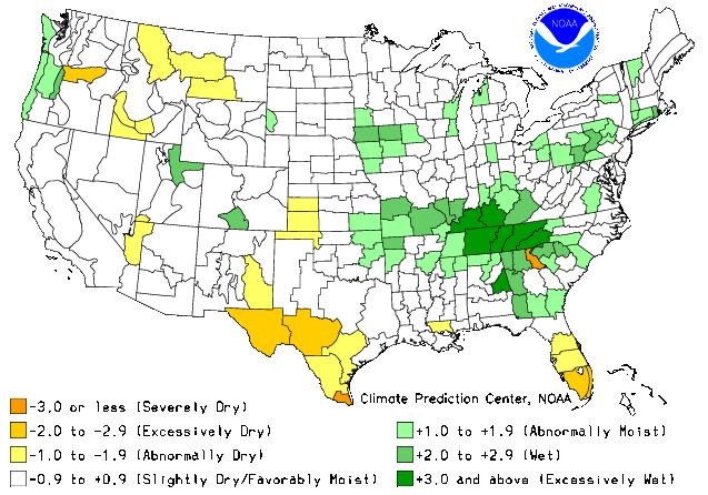
Good Morning all. That is a pattern we see quite often in June and July. If this map is correct the hottest of the weather stays to the southwest so upper 80's seem correct as we are on the edge of the ridge. Whats somewhat interesting is the weather over the extreme southeast and this can be a block for the heat to extend further east at first. Sooner or later we will get hot and most likely somewhat drier. Just hoping that we can cash in on the rainfall this month as many chances are still in the cards.
-
tron777
- Major Hurricane
- Posts: 25364
- Joined: Fri Feb 26, 2021 5:10 pm
- Location: Burlington, KY
- Contact:
Re: June 2024 Weather Discussion
From the boys earlier this morning with regards to later today:
.NEAR TERM /UNTIL 7 PM THIS EVENING/...
Southerly flow at the surface topped by southwest flow will
bring some warmer and potentially unstable air to the CWA.
Showers and some thunderstorms are progged to move from the
southwest into the Cincy metro area this afternoon and early
evening as mid level energy aids any thunderstorm development
here.
Highs will top out in the mid-upper 80s for most locations,
possibly a bit cooler in and south of metro Cincy given
increased potential for rain and cooling effect of cloud cover
ahead of it.
Re: June 2024 Weather Discussion
Heading into summer many places east of the rockies have been wet. Also in the past week folks in the northern plains and northwest are getting wet as well. This is all good news imo of at least delaying the heat for summer. Models can be really good especially reading the atmosphere but soila temps and how this can delay heating in the summer and promote cold in the winter is one the models are usually late to the party. If we can just keep the rains coming through the end of the month this will no doubt delay the heat. I know things can change quickly in the weather world but with the widespread rains of the past several months over a larger area can only help. Many times we get heat waves by the heat first extending into the northern plains and then heating up here as this cuts off any cold fronts to make even to the USA/Canada border. At the moment wet in the northern plains and rather cool so good news once again. I do believe overall for the summer near normal before all is said and done but that can be a few extended periods of heat but enough cool periods to keep us near normal.
-
tron777
- Major Hurricane
- Posts: 25364
- Joined: Fri Feb 26, 2021 5:10 pm
- Location: Burlington, KY
- Contact:
Re: June 2024 Weather Discussion
Hopefully this link works....
https://kyweathercenter.com/wp-content/ ... ISTURE.png
If so, CB posted a soil moisture map as we started June and it's a good illustration of what you are talking about in your above post, Tim.
https://kyweathercenter.com/wp-content/ ... ISTURE.png
If so, CB posted a soil moisture map as we started June and it's a good illustration of what you are talking about in your above post, Tim.
-
tron777
- Major Hurricane
- Posts: 25364
- Joined: Fri Feb 26, 2021 5:10 pm
- Location: Burlington, KY
- Contact:
Re: June 2024 Weather Discussion
81 with a dew of 69 as of 12pm at CVG. 1500-2000 J/KG of CAPE exists for Cincinnati, however we have little to no wind shear. Mid level lapse rates are also poor but low level lapse rates are pretty steep. In English, look for scattered storm development but nothing looks to get out of hand severe wise. Coverage and storm organization also won't be all that great. So some of you will get some downpours as time goes on today and others will not. Radar shows some scattered showers and storms to our SW heading to the NE ahead of a weak disturbance. For those needing or wanting the rain, good luck!
Tomorrow still looks to be the best chance for all to cash in as we've been discussing. In the extended, the 12Z GFS keeps trying to cook up a tropical system as we approach mid month and if this forms, Florida could be impacted. On this run in particular, the GFS tries to bring some of that tropical moisture our way. I suspect that the bulk of it should remain to our East in my opinion but it will depend on the orientation of the trough and where any frontal boundaries happen to stall it. We shall see!
Tomorrow still looks to be the best chance for all to cash in as we've been discussing. In the extended, the 12Z GFS keeps trying to cook up a tropical system as we approach mid month and if this forms, Florida could be impacted. On this run in particular, the GFS tries to bring some of that tropical moisture our way. I suspect that the bulk of it should remain to our East in my opinion but it will depend on the orientation of the trough and where any frontal boundaries happen to stall it. We shall see!
Re: June 2024 Weather Discussion
Good Afternoon and very muggy out there and one way to tell is many times you see a nice steady fall in dew points in the afternoon but not today and this also lends to a better shot of some scattered showers and thundershowers. Main item will no doubt be heavy rain. Still looks like Wednesday is better for an overall coverage especially further north . Will need to see the overnight coverage into early Wednesday morning to see if we will get an nice line of storms to head this way but again with the main energy moving away sometimes this takes the bite out of those storms
-
tron777
- Major Hurricane
- Posts: 25364
- Joined: Fri Feb 26, 2021 5:10 pm
- Location: Burlington, KY
- Contact:
Re: June 2024 Weather Discussion
Hopefully I can make it home before the scattered storms move in that are off to our SW.
-
tron777
- Major Hurricane
- Posts: 25364
- Joined: Fri Feb 26, 2021 5:10 pm
- Location: Burlington, KY
- Contact:
Re: June 2024 Weather Discussion
Had a few sprinkles here but the best action missed me to the West. Still watching radar to our SW for more scattered storms trying to make their way into the area. I hit 87 before the shower moved thru, now down to 74.
Re: June 2024 Weather Discussion
Missed the first round but hopefully cash in on the second round heading this way. May have a 3rd chance a little later this evening as well
-
tron777
- Major Hurricane
- Posts: 25364
- Joined: Fri Feb 26, 2021 5:10 pm
- Location: Burlington, KY
- Contact:
Re: June 2024 Weather Discussion
Hoping we can cash in tomorrow too if this evening is a swing and a miss. We could use the rain IMBY. It's been a while since we've had a good soaking, talking 0.50" or more. That shower I got right after I got home from work was basically just a trace. Barely even wet ground and it was over.
Re: June 2024 Weather Discussion
Some of these storms have been huge rain makers in a short amount of time
